I explored CERN a lot during my time there. CERN is a space in which you lose yourself very easily. As a wanderer, we sometimes want to take shortcuts, but we see that on this floor, the corridor that is on the upper floor does not exist, the angles of the corridors are not straight, there are footbridges and undergrounds, the buildings are numbered, but without any logic other than entropic. I immediately needed a CERN map app to go to the different appointments.
By dint of roaming these spaces, I wanted to have a global overview, to know how we could plan stories in it. I sought more advanced maps from CERN or CERN spaces, such as the map of the accelerator complex. This would have allowed me to plan narrative structures on these maps.
With Claire Adam Bourdarios, I learned that the Google Street View car mapped the CERN headquarter, as a way of reaching the outside public for CERN’s communication.
I immediately saw the potential in terms of available images and navigation in space. I have a poetic position, so it was not the communication of what was being done at CERN that interested me, but rather the possibility of using all this content to speak more narratively about the research done by physicists on the notions of space and time. At this point, Richard McGuire’s comic book “Here” was very inspiring. He never changes of place, but he collapses hundreds of different epochs, creating a narration by their juxtaposition on the page and their succession from page to page.
Jean-Yves le Meur also showed me that on the Cern Document Server there were many archive images and that they could be relocated to Google Street View.
I left to get more information from the person who brought the car from Google to CERN in 2010, Maximilien Brice. I also wanted to know if there were particularly unusual places (like the hidden Legos in the CERN Computer Center, he told me).
Some technical elements:
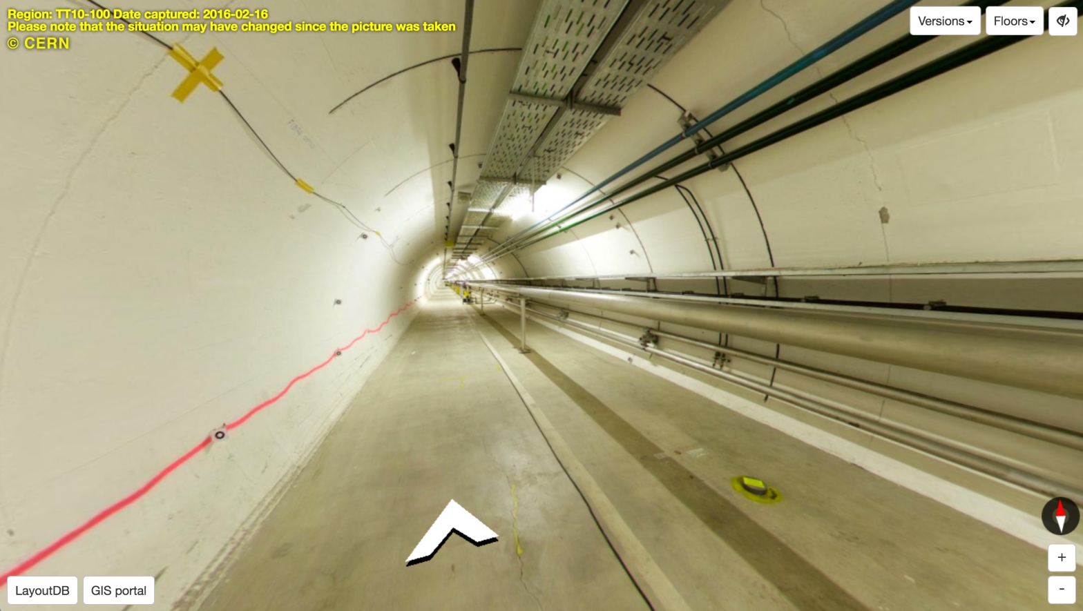
Google came for free, also because they were testing capture tools, for inside tunnels for example. These are prototypes of robots for hiking. Several prototypes have thus been tested: the EPS has been modeled so that their trolley, guided by its lasers sensors, can take the photos automatically. If it’s manual, you have to make the photos with a compass, to always know where the north is. The work for the car throughout all CERN took a day, while the cave and its different levels, taken with the robots, took four. Their software places the images automatically, but then it was up to Maximilien to do manual checking. It took 2 years to get everything up and the images were uploaded in 2013.
Then, Maximilien showed me that the CERN mapping department later reused this technique to continue the work and update it. Thus, in the internal CERN map system, the GIS, in addition to all information layers, we can access 360° views of tunnels and experiments. It is useful for engineers, because in this way they have a view on some installations and information about technical pieces without going there each time.


This tool is not visible to the public. That’s why, after more research and testing with the Google Street View APIs to find out what was possible, I decided to concentrate on this, and not the GIS, to give a digital writing workshop to those members of CERN who were interested (see article “Thinking Alleys’ workshop”).
To go further : http://smb-dep.web.cern.ch/en/content/isp
